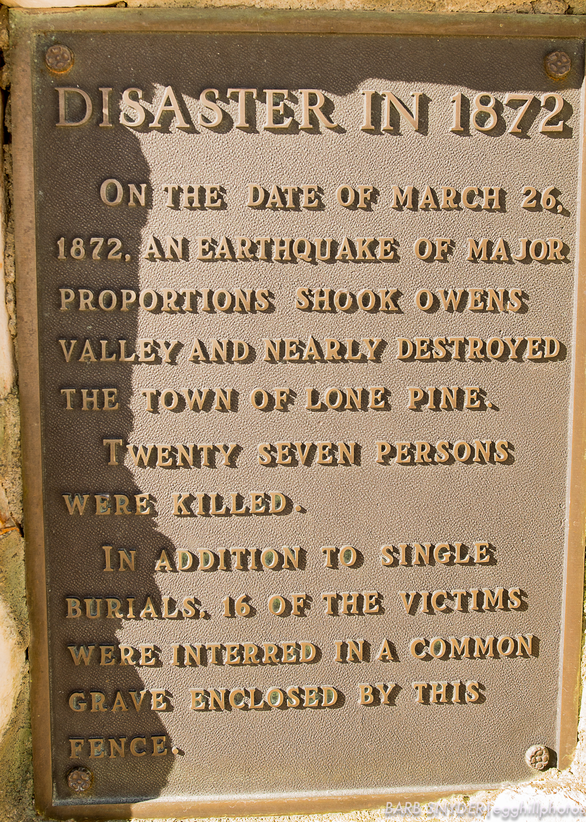
A recent drive through Lone Pine, California allowed for enough time for a few photos of the Eastern Sierras and a graveyard created for victims of an earthquake that happened on March 6, 1872. As you may know, areas of California are prone to earthquakes due to the many fault lines lying crisscrossed just under the ground. There is a good explanation of the earthquake that claimed the lives of 27 people and was believed to be the largest (8.2 to 8.6 on the Richter Scale) in the contiguous United States in the following link: Sierra Nevada Geotourism Map Guide.
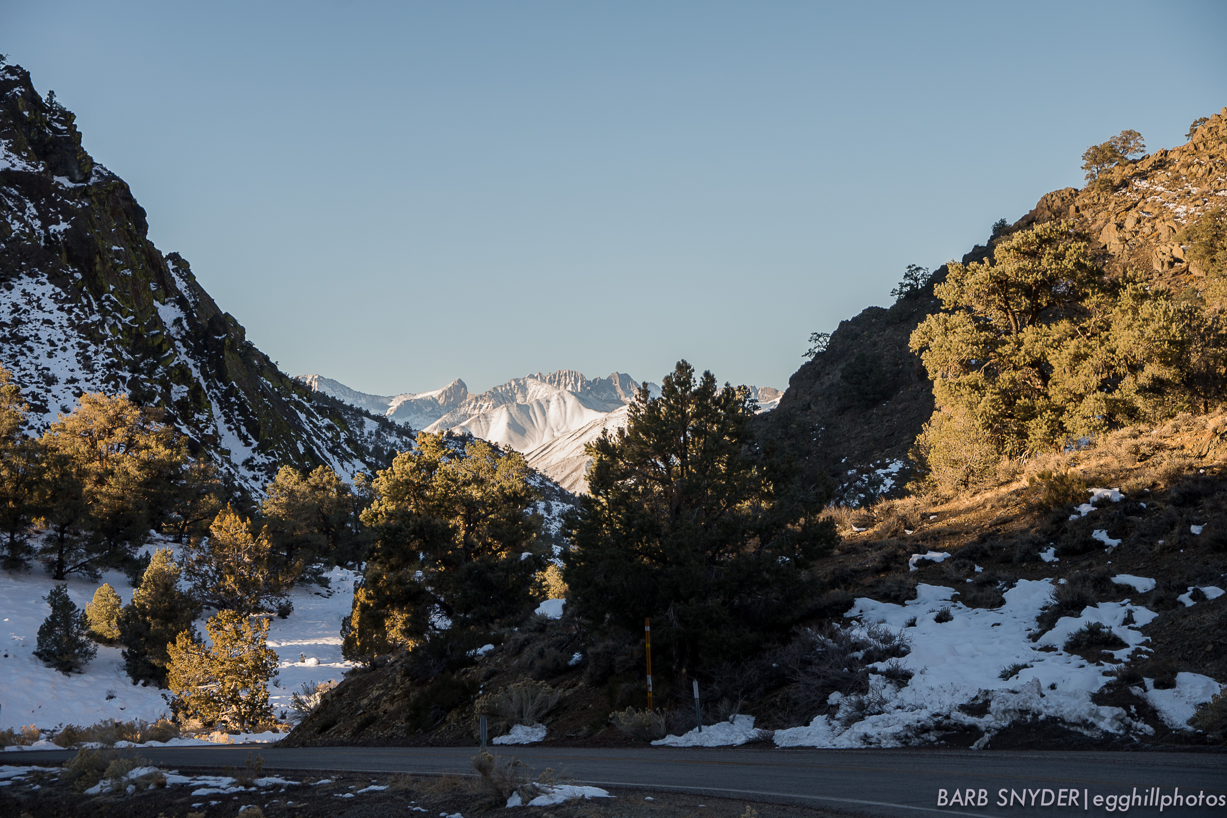
The pass through the Inyo and White Mountain range, with a view of the Eastern Sierras.
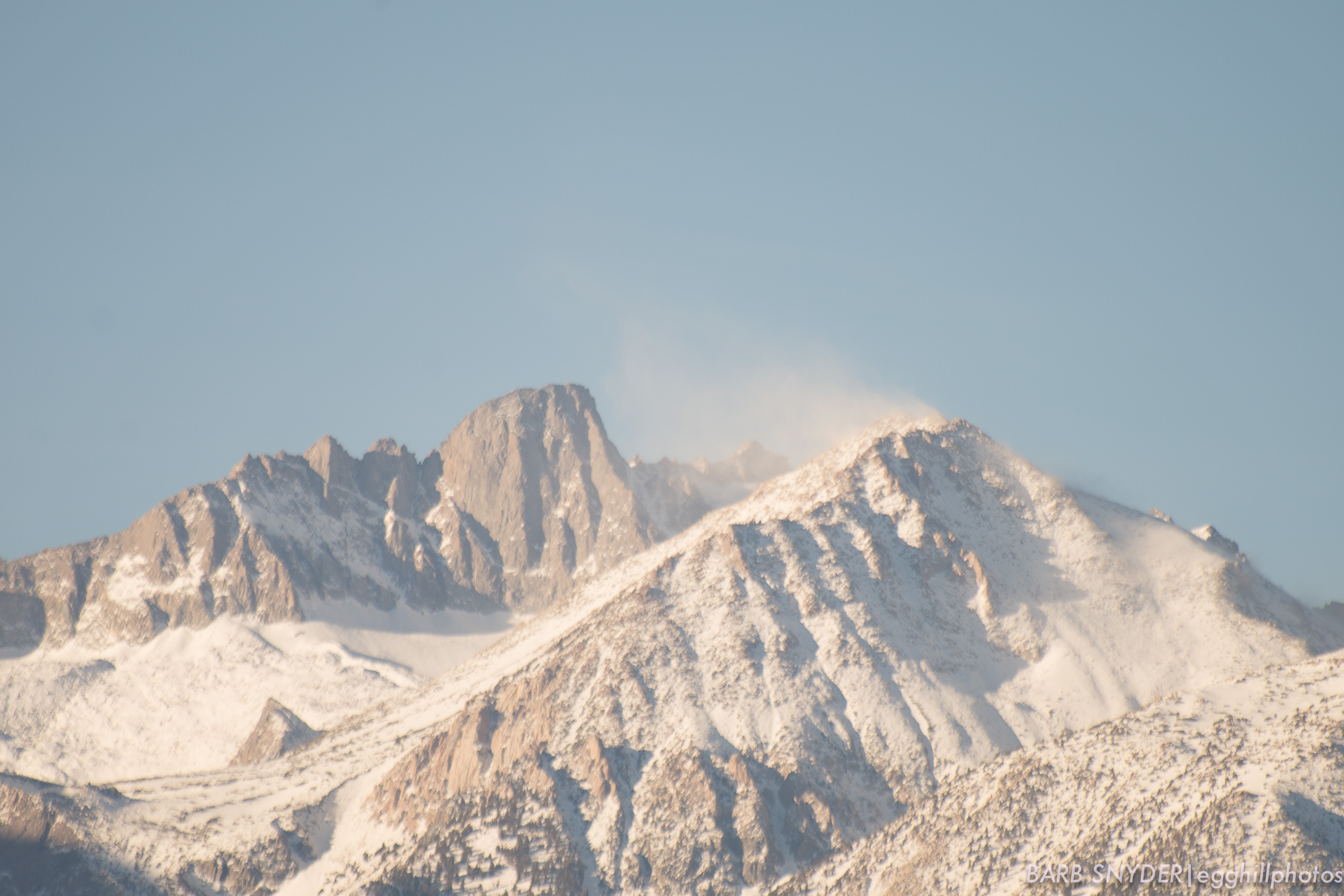
Cold blowing snow on the way to Lone Pine.
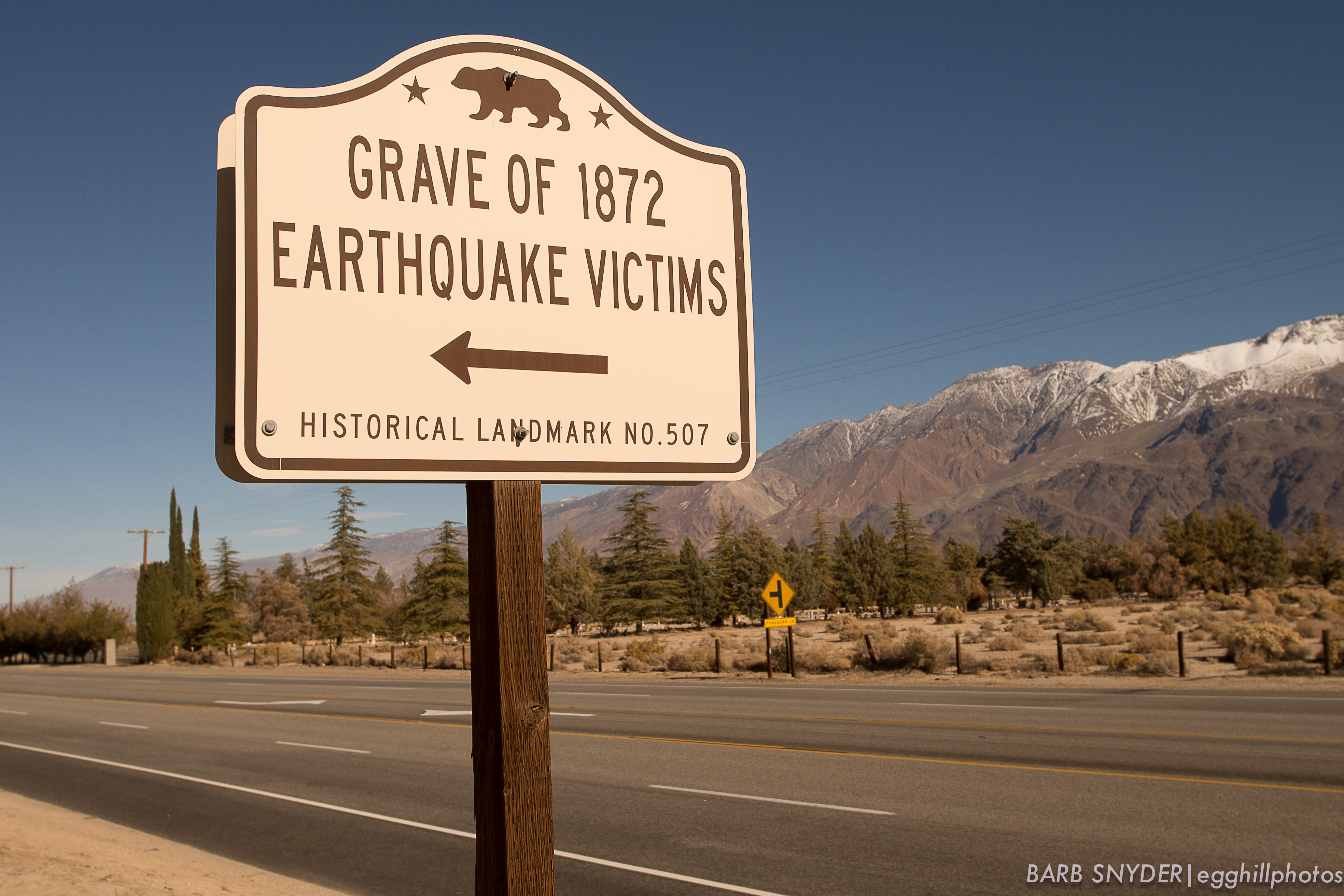
The roadside sign for the 1872 Earthquake Victims. The quake was thought to be similar in size to the San Francisco quake of 1906. Two faults moved simultaneously. The vertical fault moved roughly 15-20 feet, while the right lateral fault moved roughly 35-40 feet. The twin faults run along the base of the Sierra Nevada and Inyo Mountains, according to USGS and Wikipedia.
The Alabama Hills are below the snow line (so far).
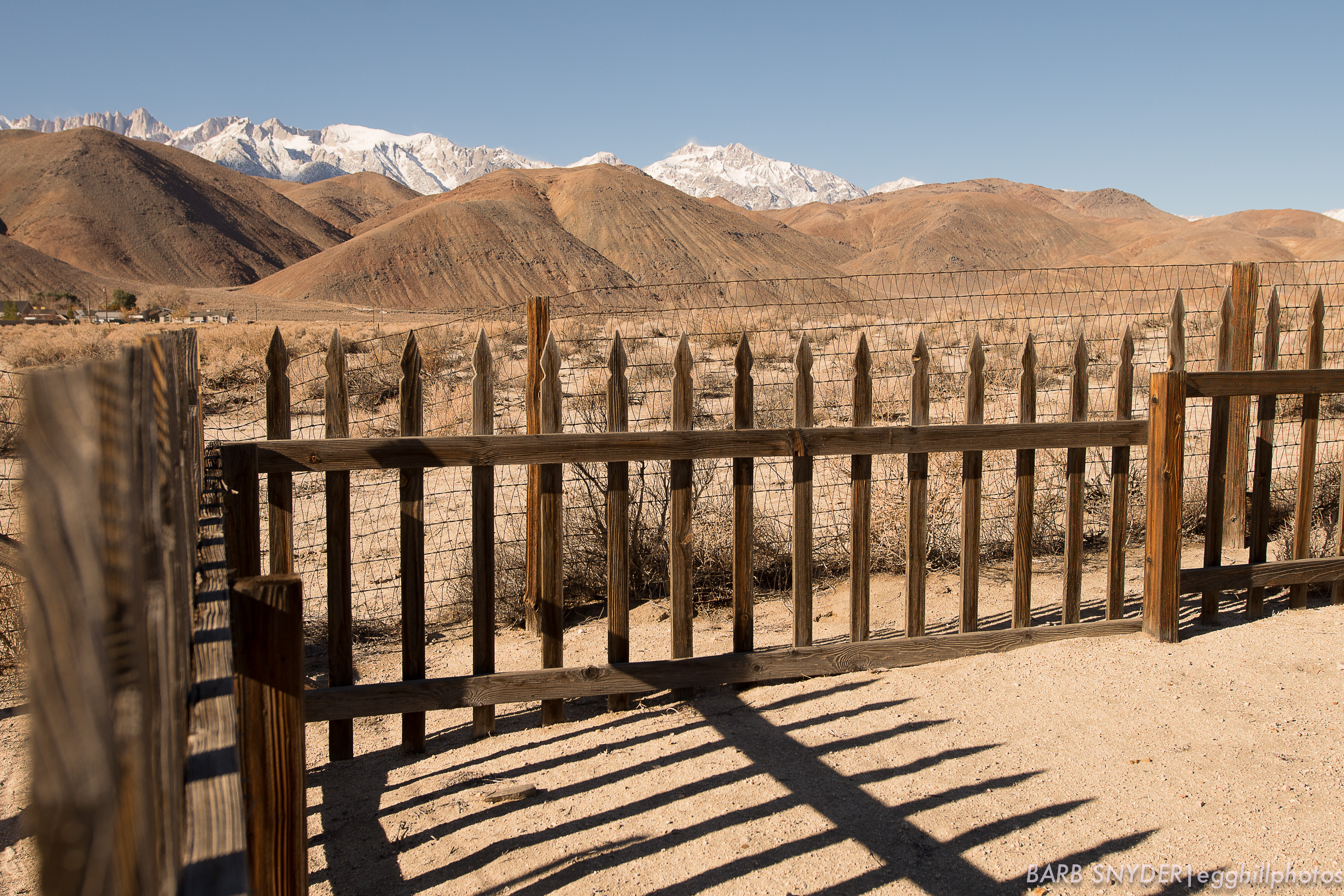
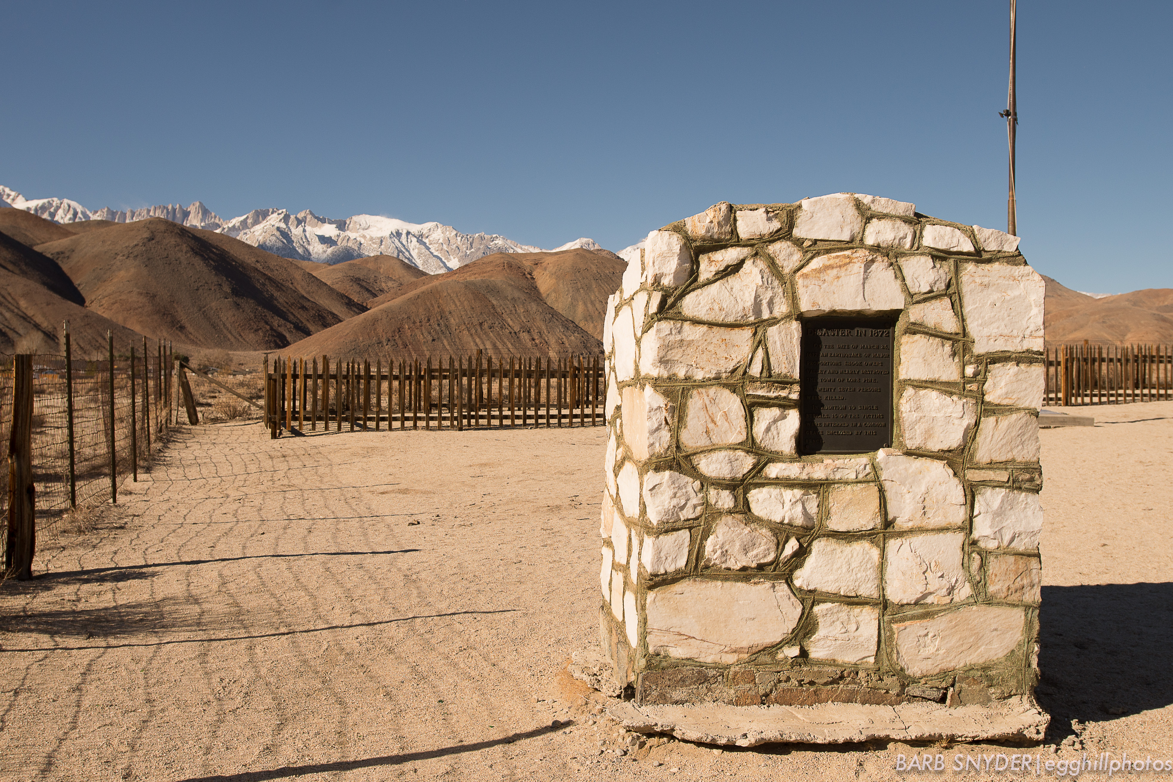
The fence encloses the mass grave. Mt. Whitney is the highest peak in the background (too steep for snow cover).

Leave a comment