I traveled to Mammoth Mountain last week and have only just scratched the surface of the many sights there. Since its been 100 degrees and higher for 4 weeks now in the valley, going up to the higher elevations is a treat since its so much cooler.
My first visit was to the ranger station for maps and tips. I listened to a very informative talk about bears, cougars, coyotes (and gosh there was one more-can’t remember-hope I don’t meet up with him.) 😉 The ranger did say that during the daylight hours, the only danger from bears is being drooled on from above as they’re napping in the trees. Bears and cougars are crepuscular (hunt at dusk and dawn) and are usually not active during the day. Coyotes are supposed to be nocturnal, but I’ve seen them out during the day. The big thing for me to remember is to not carry too much food with me, as bears will tear your car apart looking for it. I also have my first back-country mountain bike trip planned.
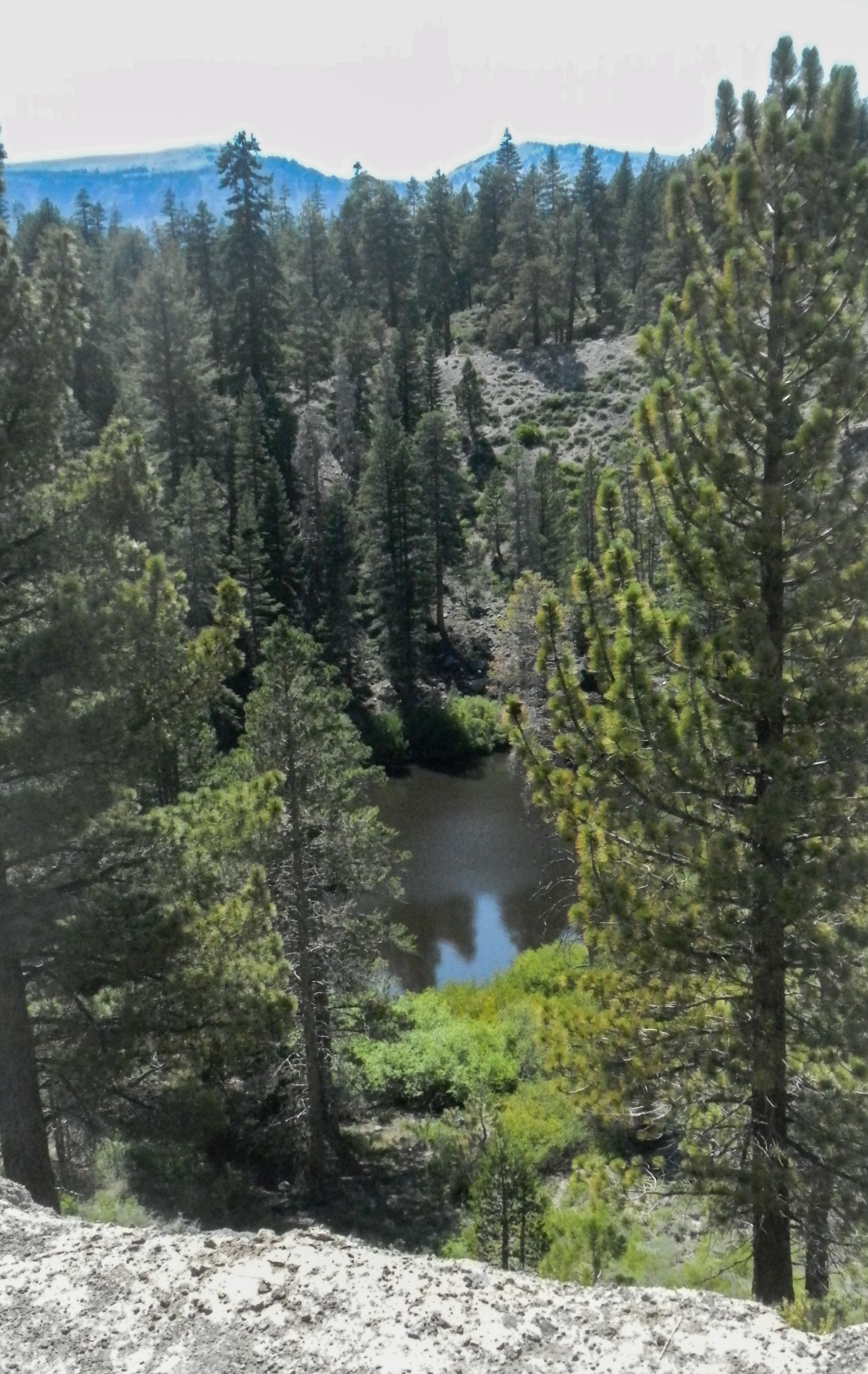
Mammoth is a very active volcano and earthquake region, so my first hike was to the Inyo Craters. There are so many earthquakes and tremors, there’s a seismograph in the ranger station; the wind blows the trees so hard sometimes that tremors down to the tree roots set off the seismograph. I saw two of the five craters that were formed when rising lava heated the underground water and blew steam, rocks and dirt sky-high (only about 550-600 years ago). Geologists figure that these craters were all formed within just a few days of each other. As I was hiking through the forest, I began huffing and puffing and kept having to stop. Then I realized I was at around 9,000′, a mere 5,000′ higher than the Owens Valley. The altitude sure made me slow down. I also noticed the lack of birdsong. But once I got up to the rim of the first crater, I figured out where the birds were – by the water of course. Layer after layer of birds circling down to the water which was about 150-200 yards below me (difficult to gauge when you’re looking down).
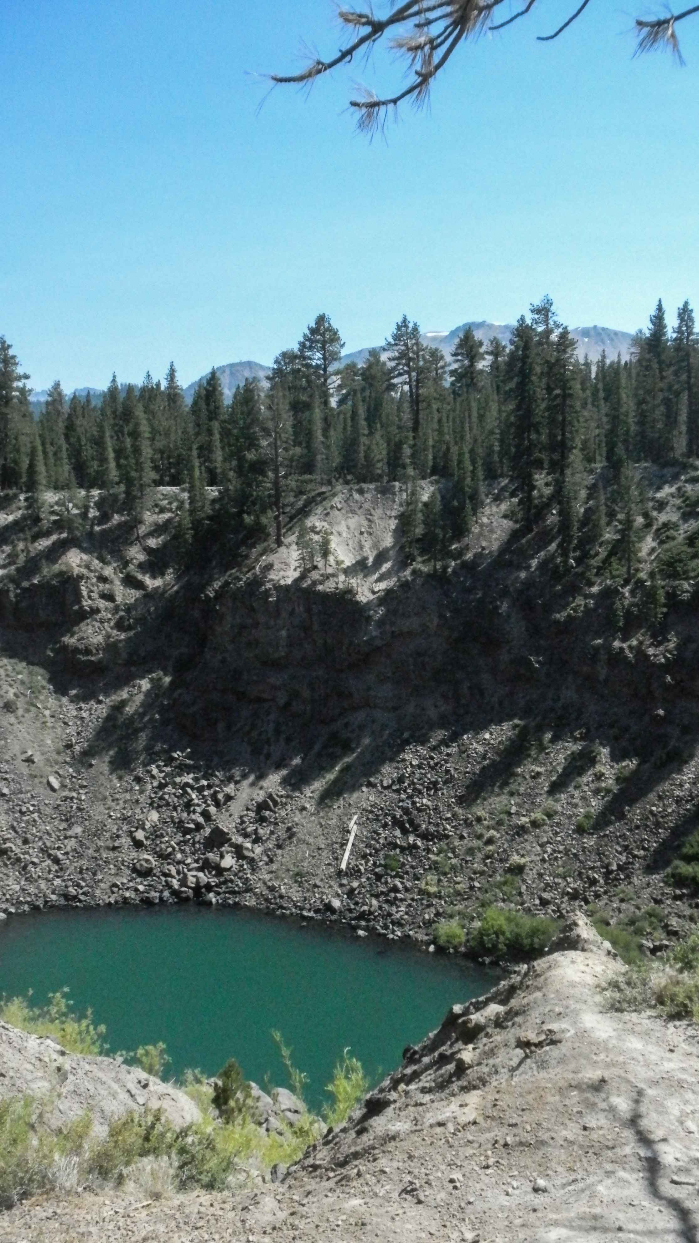
The color of the water is from the minerals in the region.
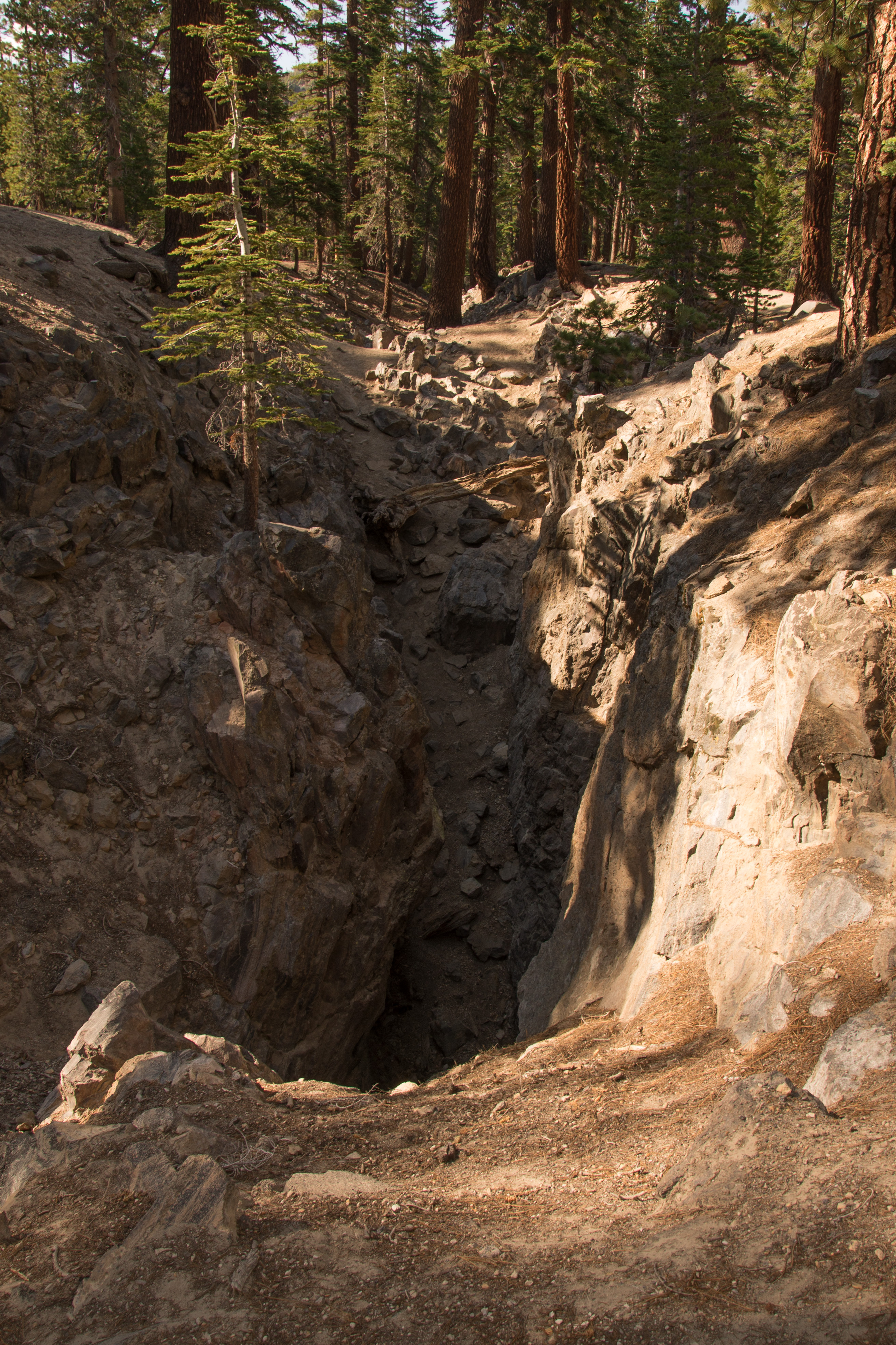
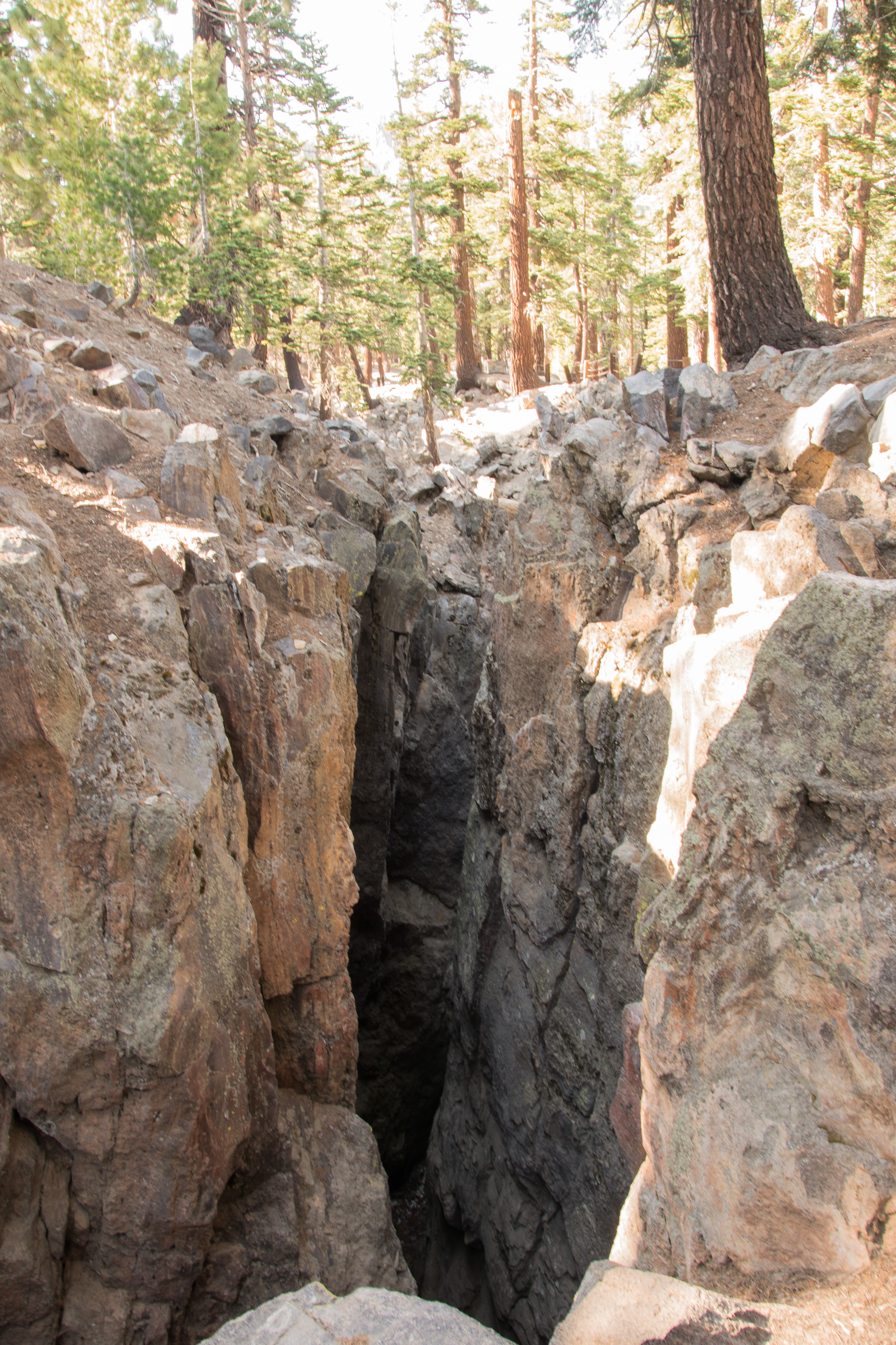
My next stop was at the Earthquake Fault Line – as it says on the sign. But it’s actually a fissure that was formed at the same time as the craters a couple miles away. Rock split away from itself but didn’t fall back together (the sides of the fissure walls match each other like puzzle pieces). They’re pretty deep, you can’t tell from the photos, but there was still some snow down in the very bottom. Early settlers of the region used to use the fissure as their food storage locker.
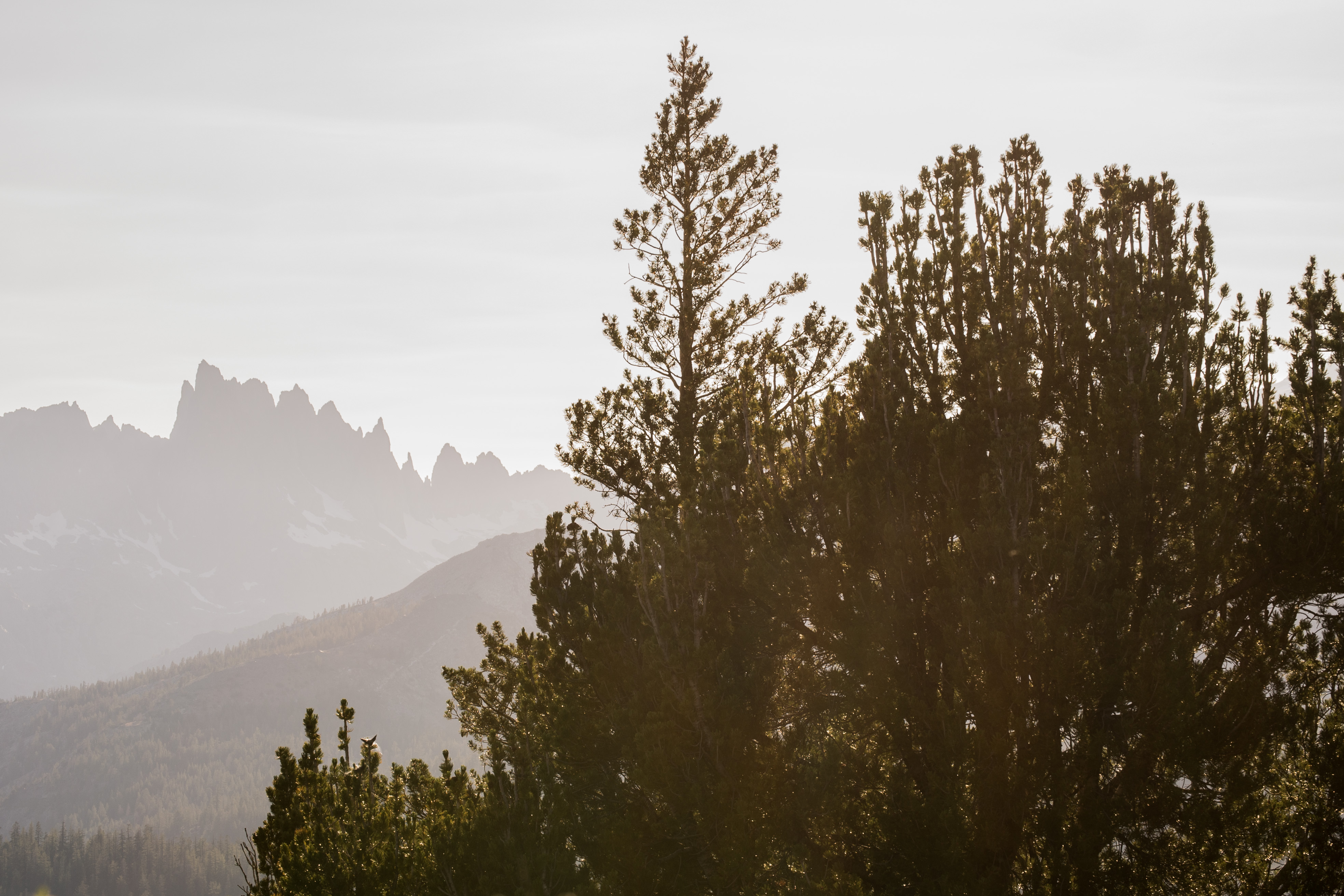
Near the end of the afternoon, I traveled to Minaret Overlook. The wildflowers were scrumptious and the views breathtaking. There’s a bit of a smoky haze in the west from wildfire smoke probably from Idyllwild where over 27,000 acres were still burning until out of control until some rain hit this past weekend. Mileage wise, it’s probably 350 miles south of Mammoth.
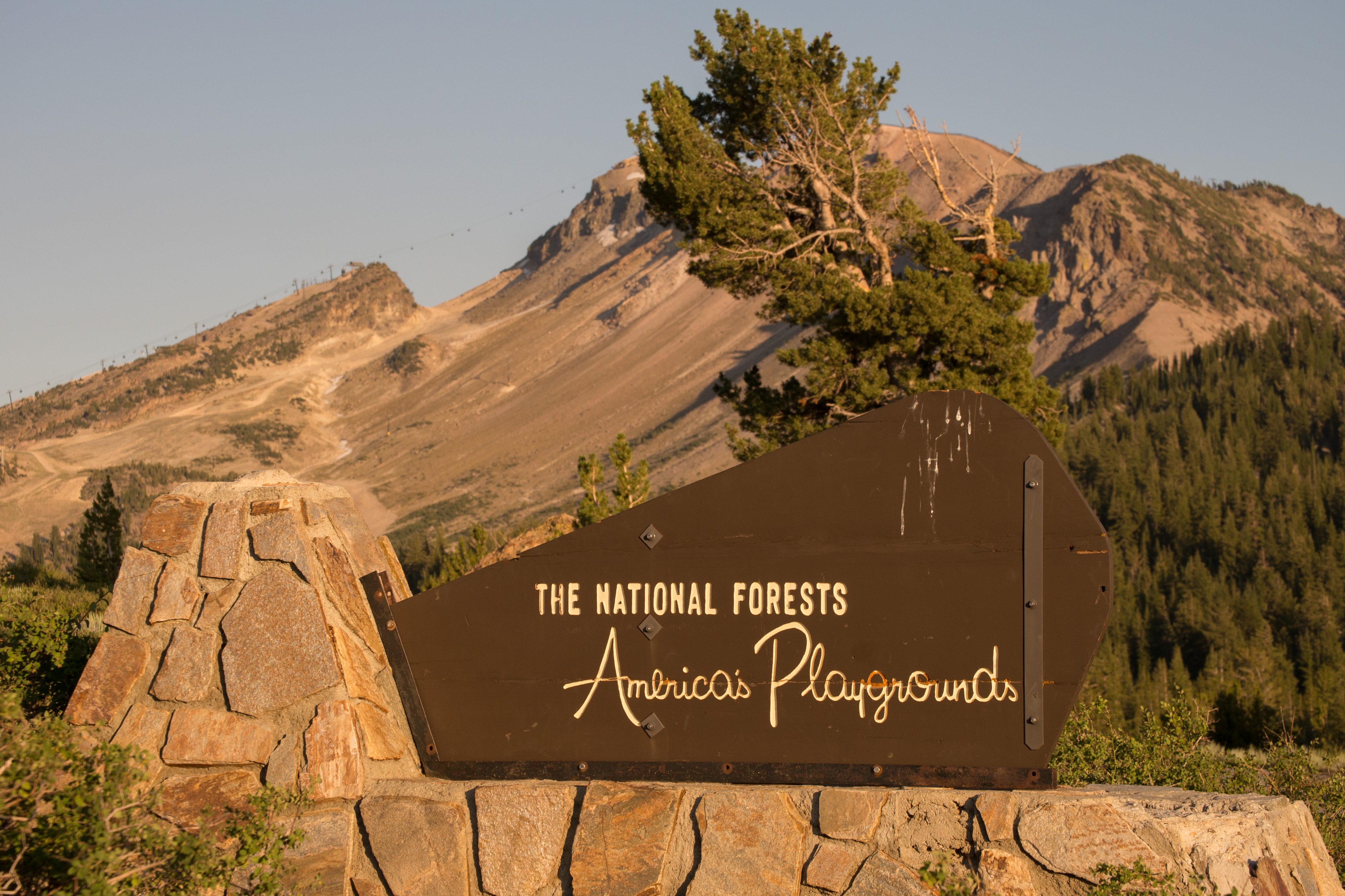
If you look closely at the top of the mountain, you’ll see the gondolas that the skiers (and mountain bikers use).

Leave a comment